SkyReview Satellite Monitoring
Place your portfolio in orbit.
Now in Beta. Limited access now available.
introduction
What is SkyReview?
SkyReview is an earth observation platform specifically engineered to monitor built environments. On a monthly basis, we publish property analytics captured from orbit - moisture beneath roof surfaces, roof material age, roof replacements, deficiencies, tree overhang, biological growth, and drainage.
-
Innovation
Our platform harnesses novel methodologies for assessing satellite imagery and breakthroughs in image enhancement called Super-Resolution.
-
Efficiency
Unlike competitors with expensive overhead, we utilize public satellite imagery & spatially enhance it to provide greater clarity.
-
Expertise
Our model combines knowledge across architectural & geospatial domains to process earth observation data into valuable analytics.
How does it work?
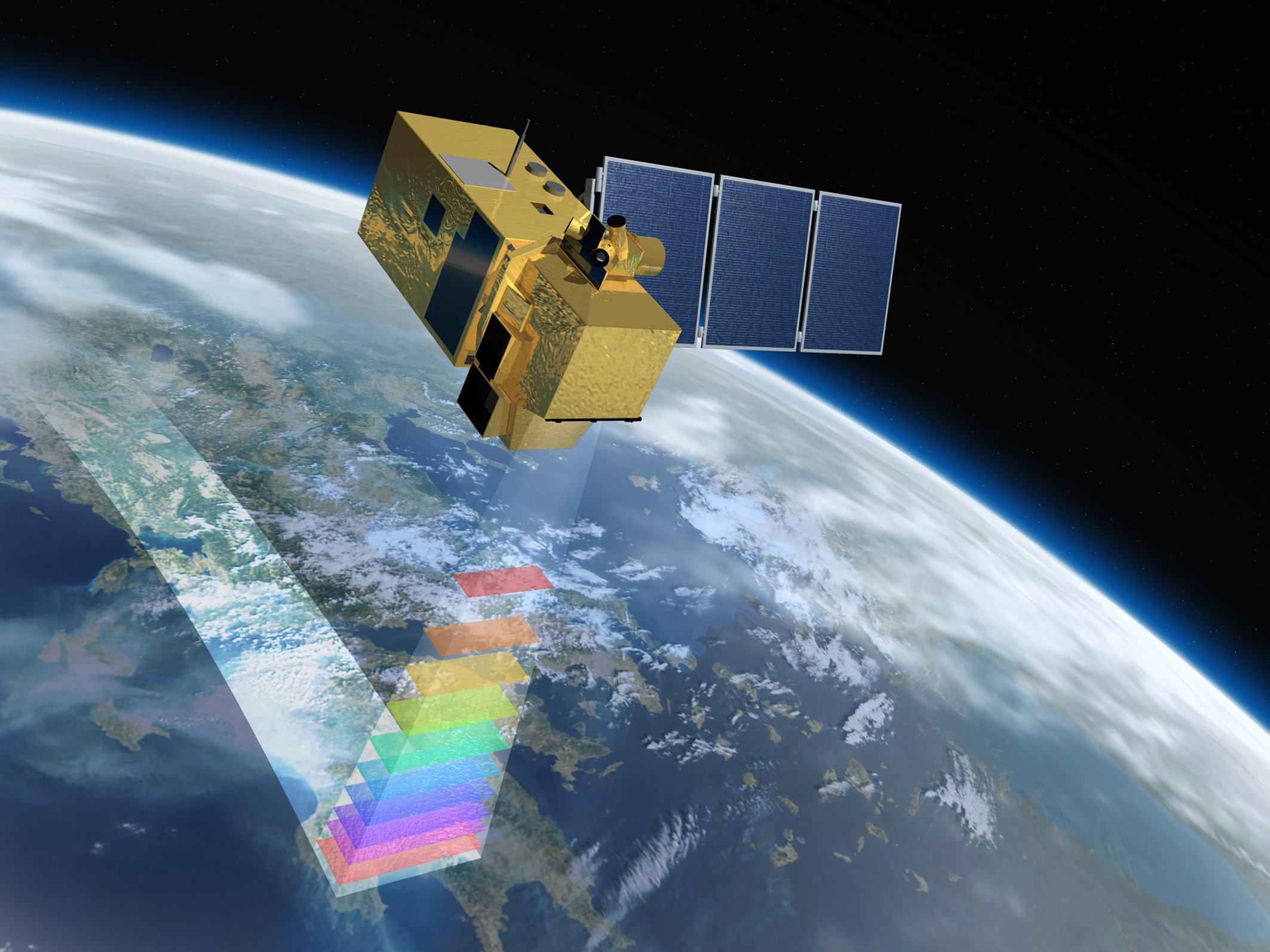
Sentinel Satellite Constellation Imagery
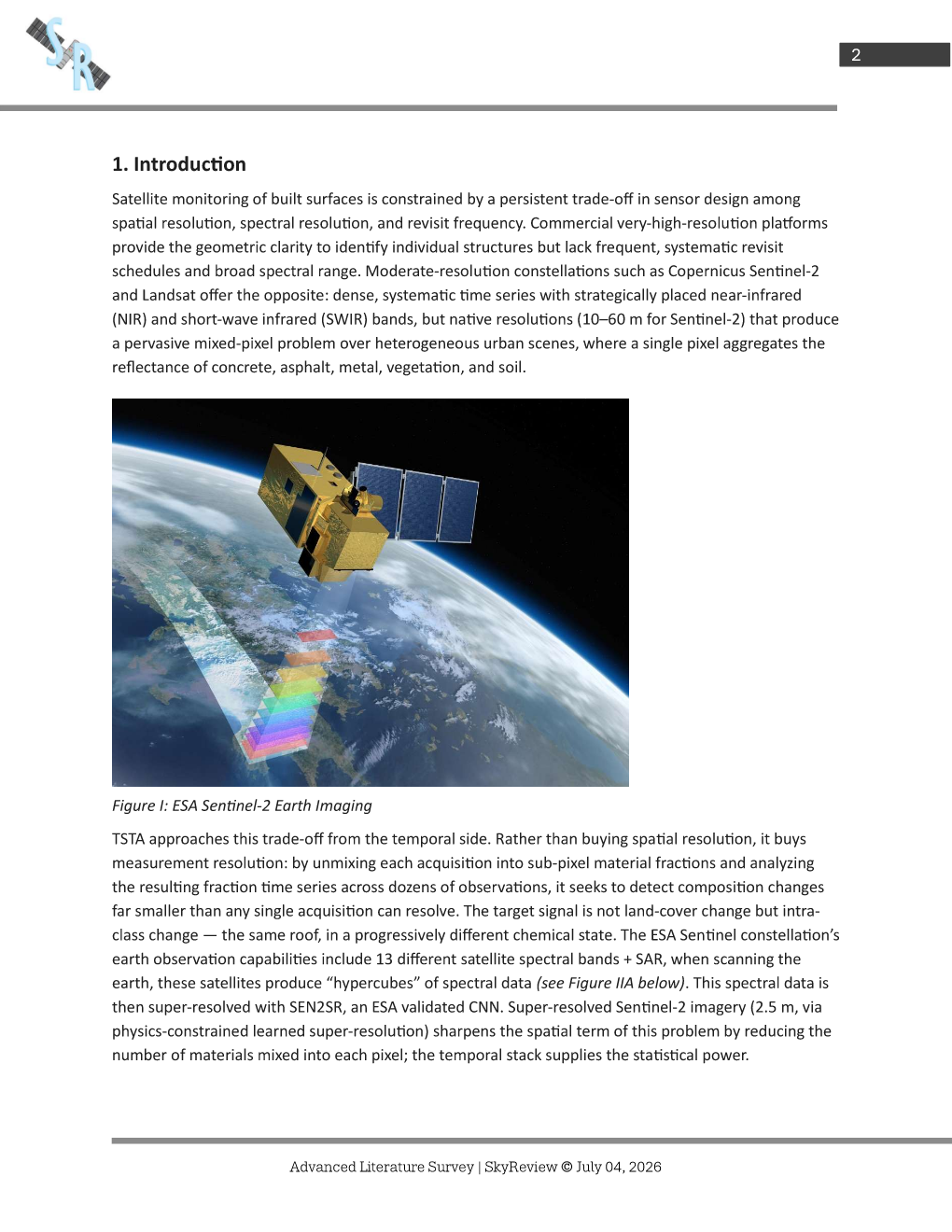
The ESA's Sentinel-1A/B & Sentinel-2A/B satellites harvest spatial imagery while in low earth orbit, on 5-6 day cycles, producing multiple scans per month. Scans produce imagery with 12 spectral bands + SAR, including infrared that enables our moisture detection feature.
Google Cloud Computation Engine
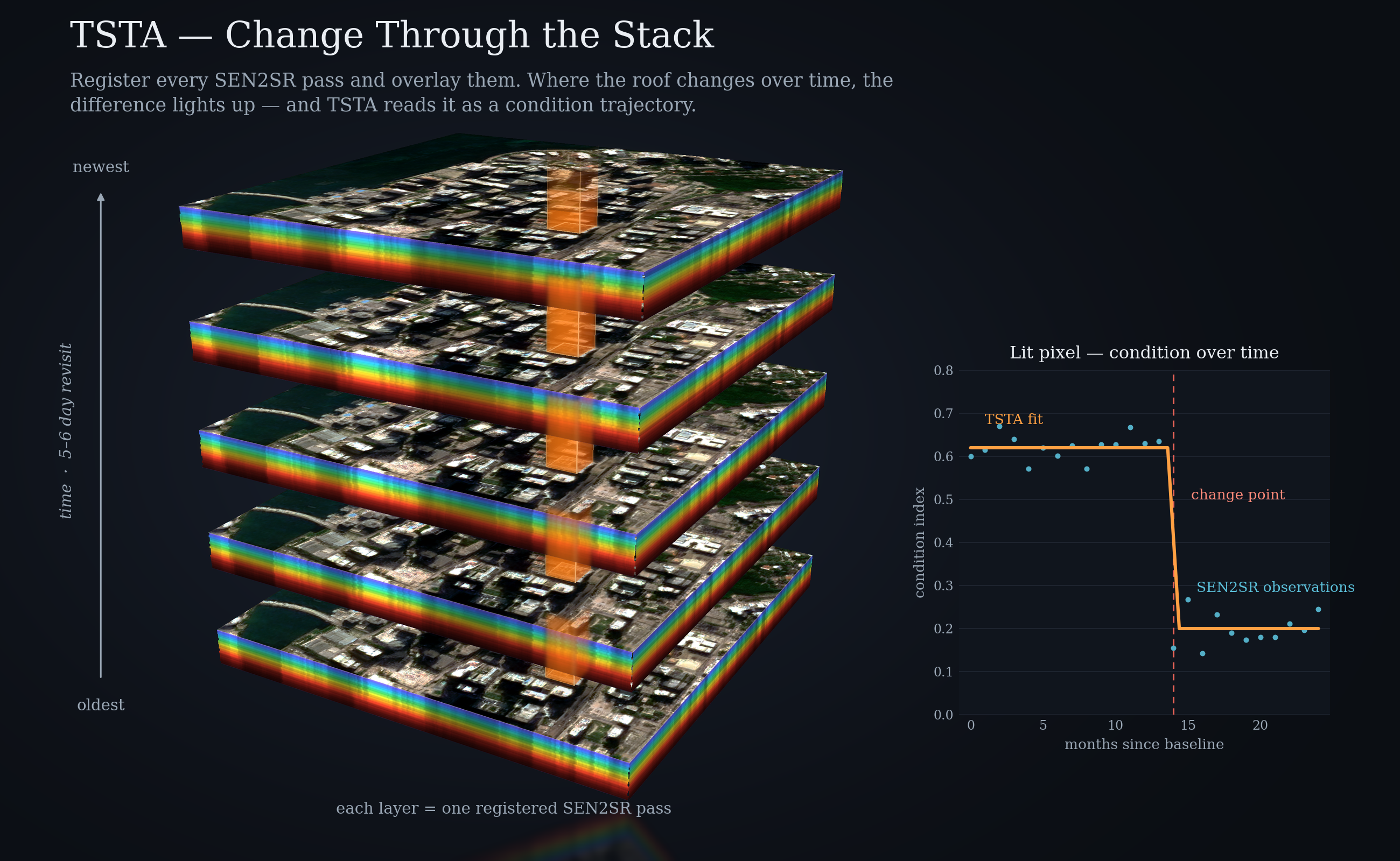
SkyReview's geospatial technology is powered by Google Cloud Computation Engine & Earth Engine. The pipeline uses machine learning to enhance commercial satellite imagery, then analyzes/processes the data with physics-based logic, TSTA (Temporal Spectral Trajectory Analysis), albedo broadband, learning algorithms, weather patterns, & permit data to prioritize inspections and improve asset management.
Super-Resolution Image Enhancement
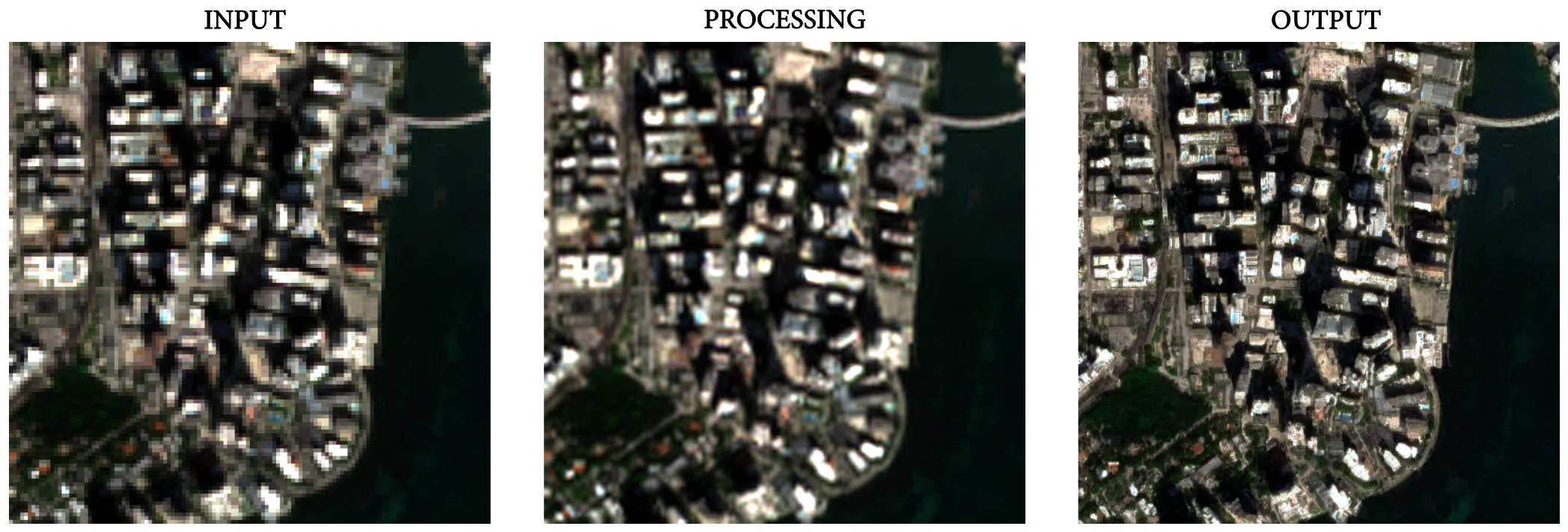
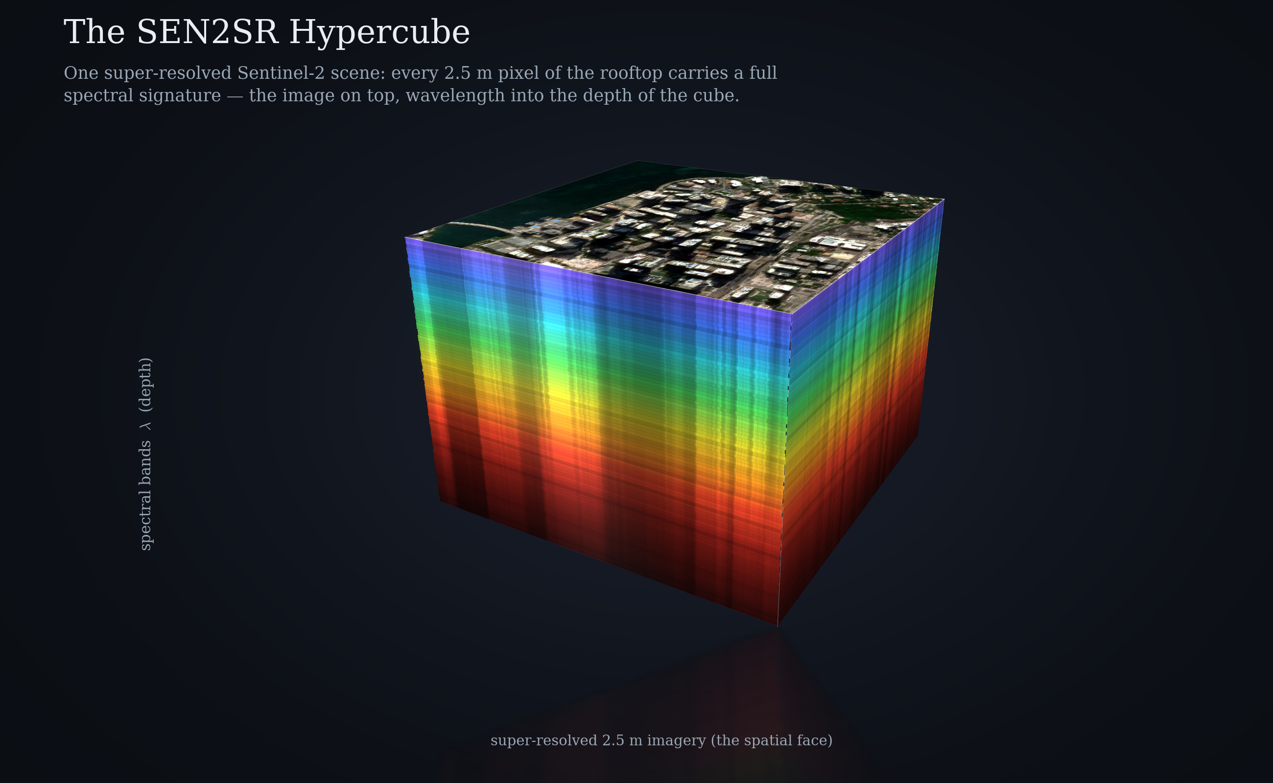
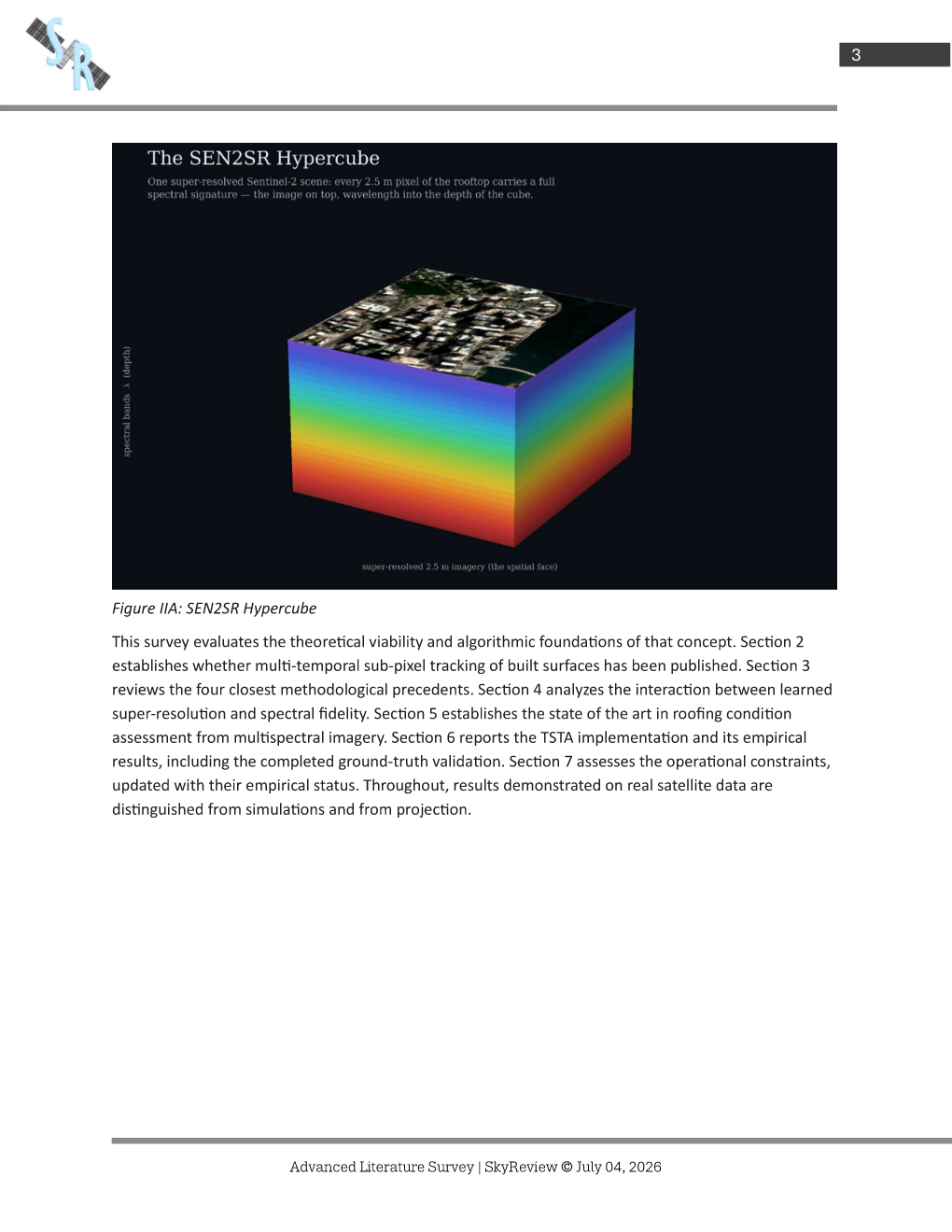
Satellite imagery is enhanced using European Space Agency validated convolutional neural networks, SEN2SR and Real-ERSGAN, creating a "hypercube" stack of enhanced spectral data.
Processing/Analysis
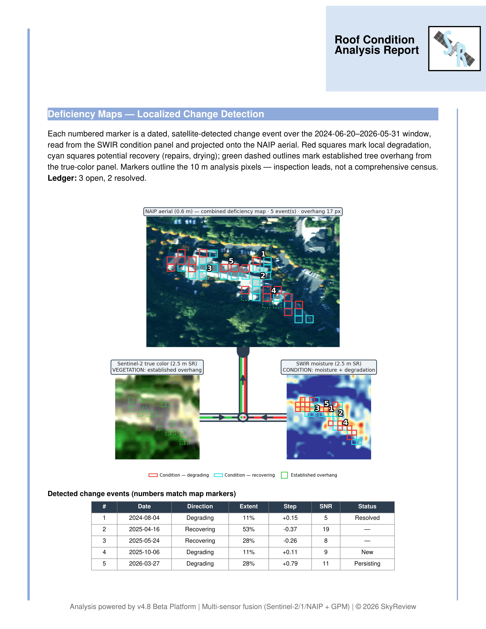
First, hypercube stacks from the whole month are unmixed and assessed with TSTA to detect changes in condition. Then, SkyReview processes the photons & data with a reasoning model trained on 100+ commercial roof inspections & thousands of roof permits. Our scans are archived to account for previous context, permit data, and weather patterns.
Reporting
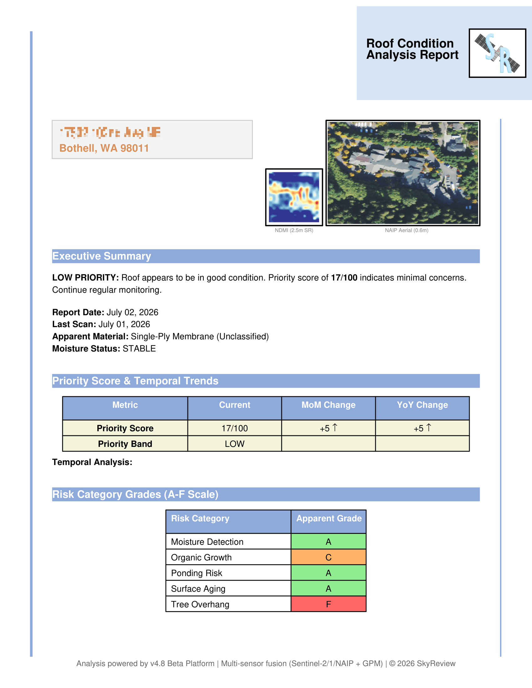
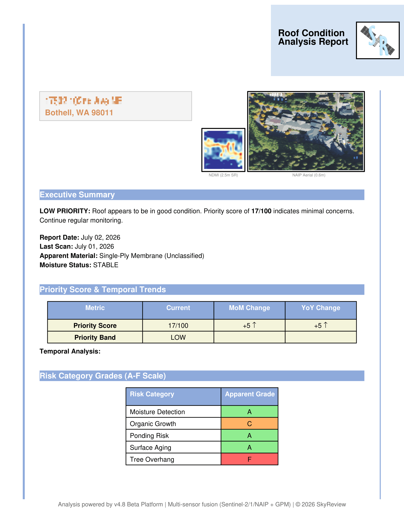
Finally, the model outputs a report. The data provides urgency rankings, actionable metrics, and recommendations to assist with portfolio management.
DESIGNED TO IMPROVE OVER TIME
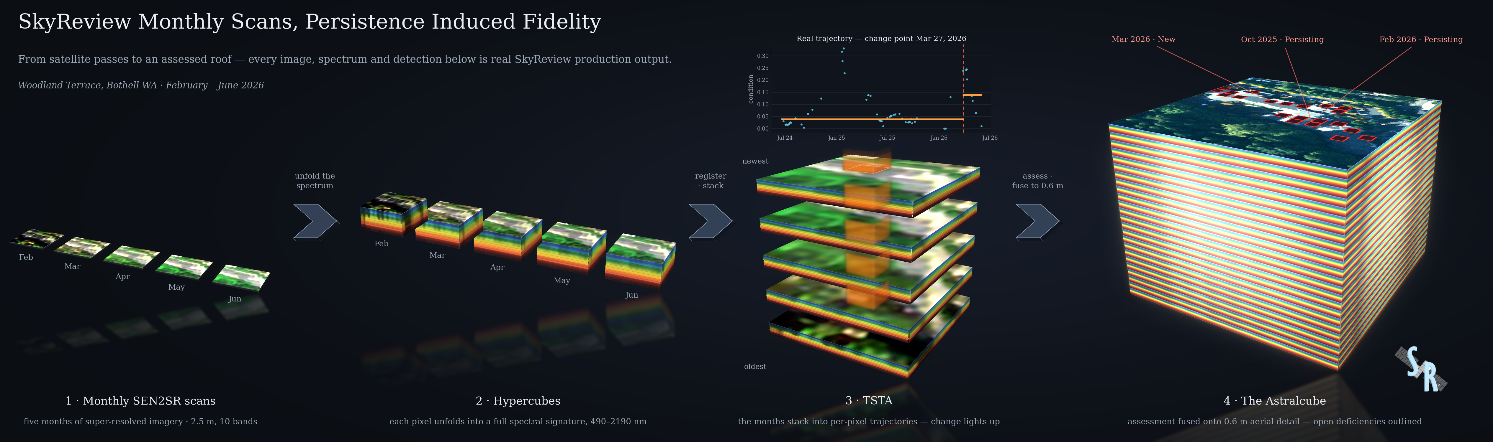
As the library of reports expands, model performance improves. As hypercubes stack over time, they begin to form a "spectral ingot" of concentrated spectral data. By tracking spectral data and producing spectral ingots - anomalies get confirmed, deficiencies are tracked, damage spread is measured, transient moisture is identified, tree overhang + vegetation are registered, and hallucinations are reduced. Through persistence, you achieve fidelity.
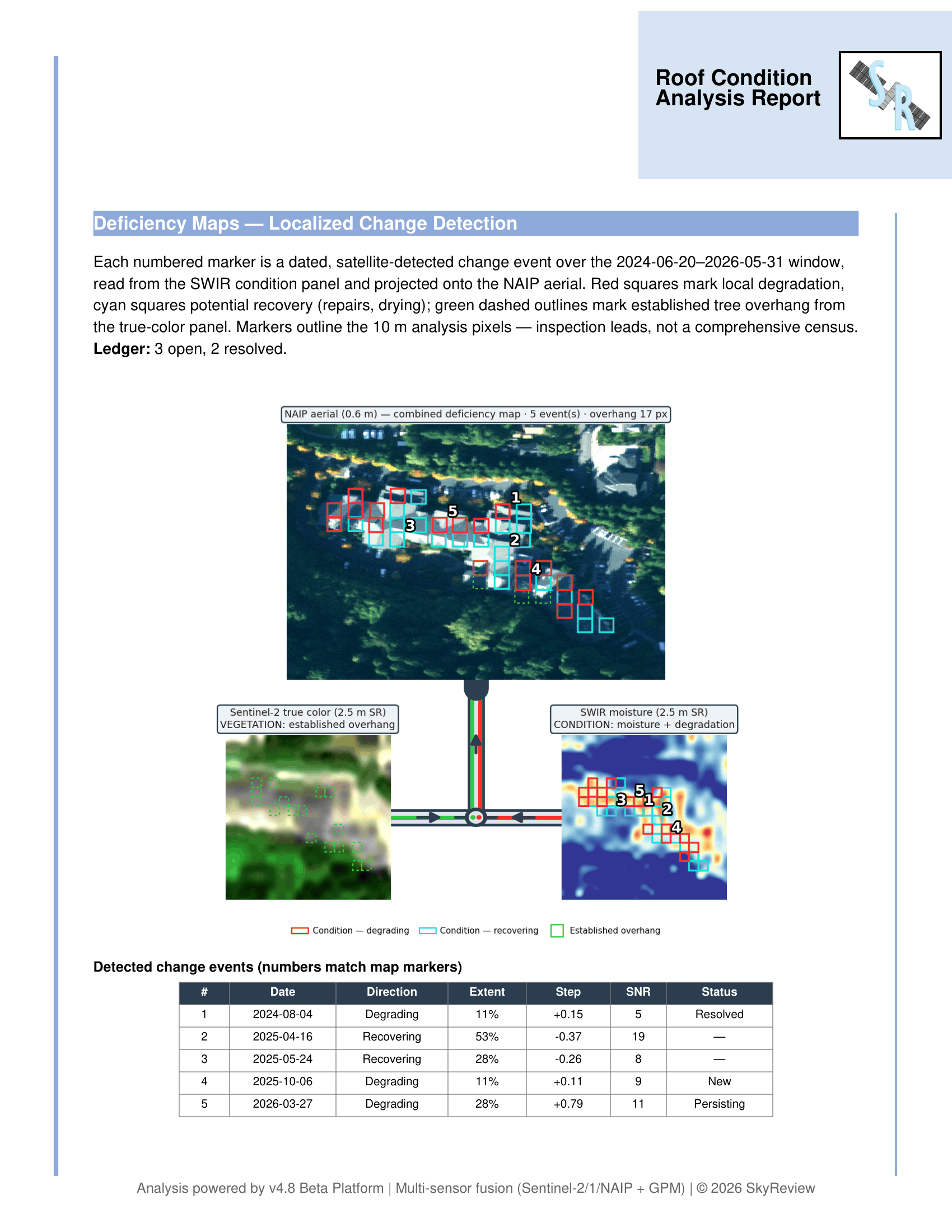
report samples (full size)
View Report Samples (Full Size) Hide samples
Why SkyReview?
We Improve Decision Making
Fulfilling an Industry Need
Building Engines, a JLL Company, recently surveyed CRE professionals and 90% reported that improved data analytics for building operations would provide the greatest benefit to the industry. - The State of Commercial Property Management Technology, 2025
Asset Management
Centralize your roof portfolio and monitor assets at scale, with global coverage. Our monthly deliverables provide actionable data & recommendations to improve capital management.
Risk Pattern Identification
With multiple scans per month and satellite bands + SAR (Synthetic Aperture Radar) capable of seeing beneath roof surfaces, SkyReview grants Owners the ability to spot emerging risk patterns.
Statistical Risk Modeling
Leverage statistical models trained on real inspection experience and permit data to accurately estimate the probability of issues, enabling resources to be prioritized to where they're most needed.
Improved Analytics for Optimal Resource Allocation
By receiving early signals for inspection urgency, reducing unnecessary site visits, & increasing the probability you find costly leaks before they fully breach roof systems; we can deliver Owners the valuable data they need to optimize their budgets, and at one the most rapid orbital frequencies in the industry.
Maintenance Prioritization Score
Roofs are ranked by inspection urgency with a portfolio-wide prioritization score, helping teams easily digest information and focus their attention effectively.
Asset Life Extension
Monitoring platform capable of deferring capital & extending roof lifespans.
 Data Protection
With SkyReview, your data is treated with respect. You rest assured that it is secure and will never be transferred or sold.
Technical Resources
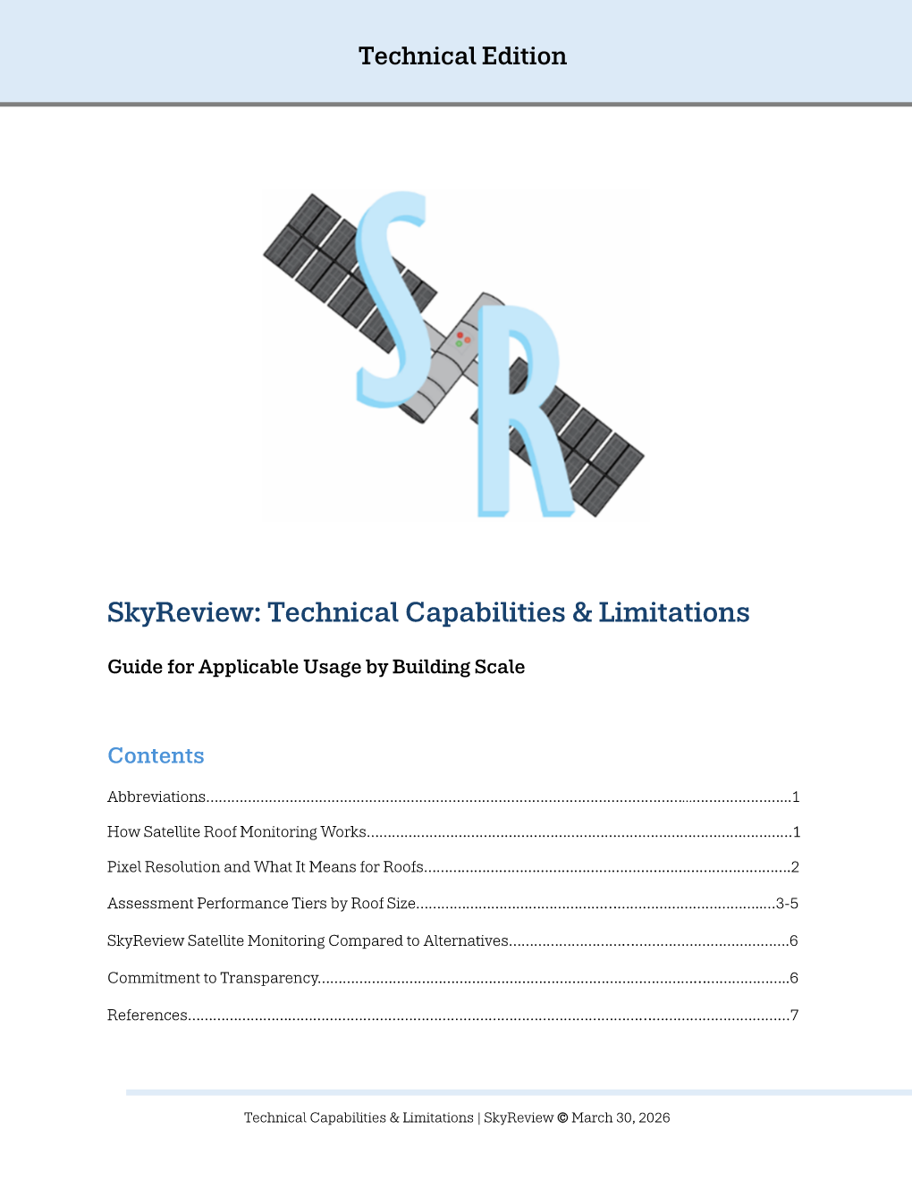
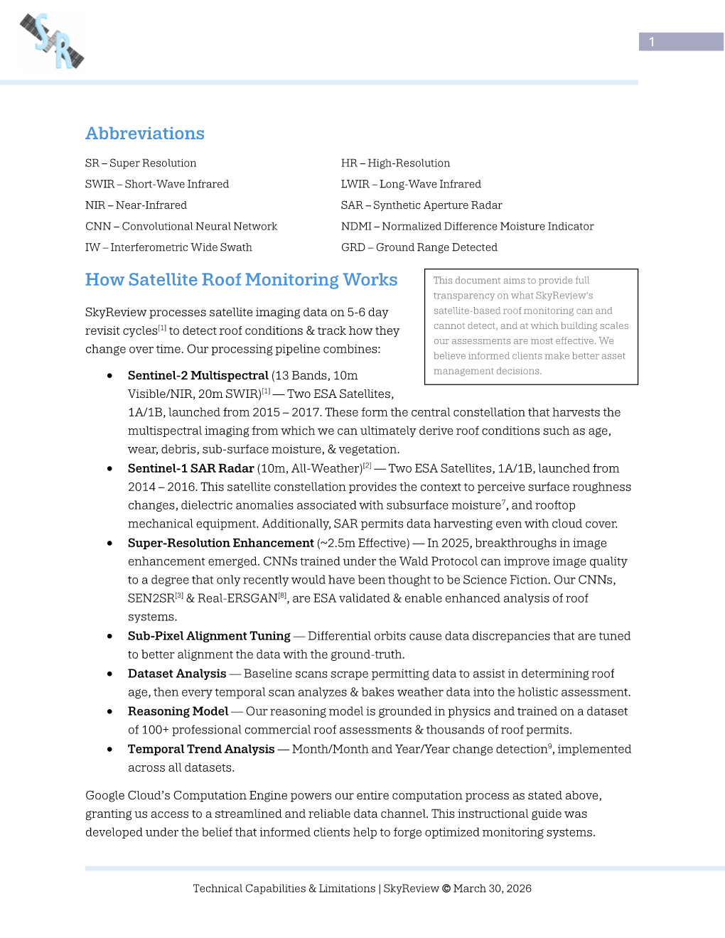
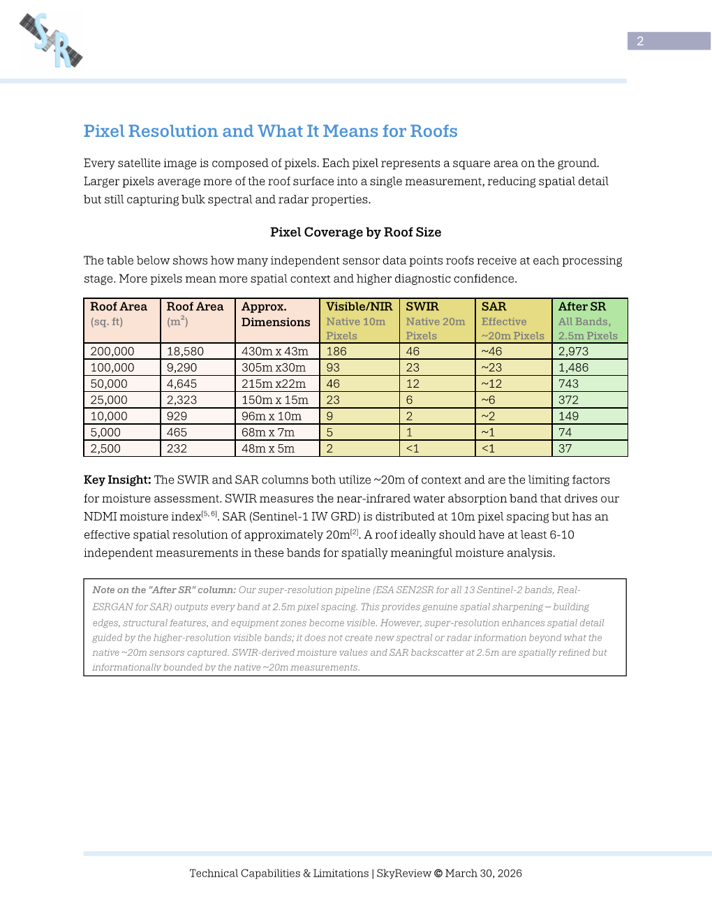
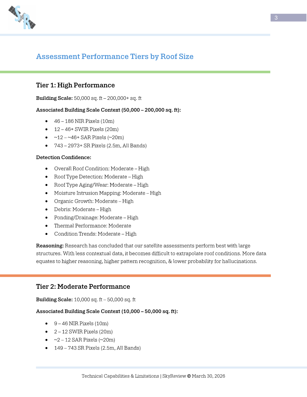
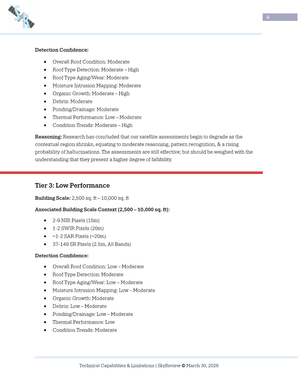
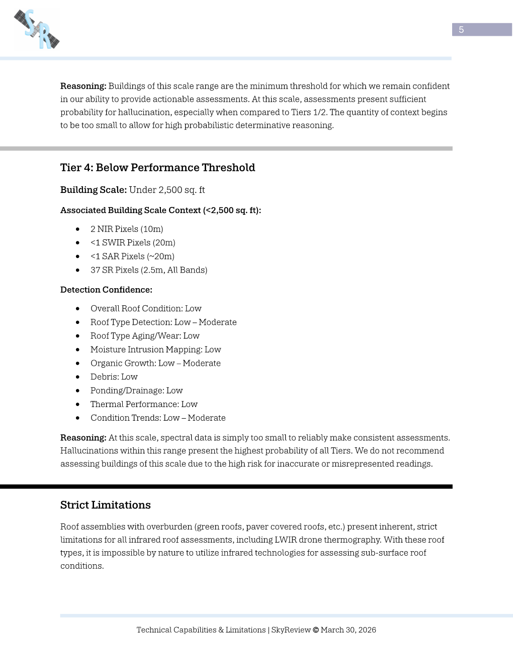
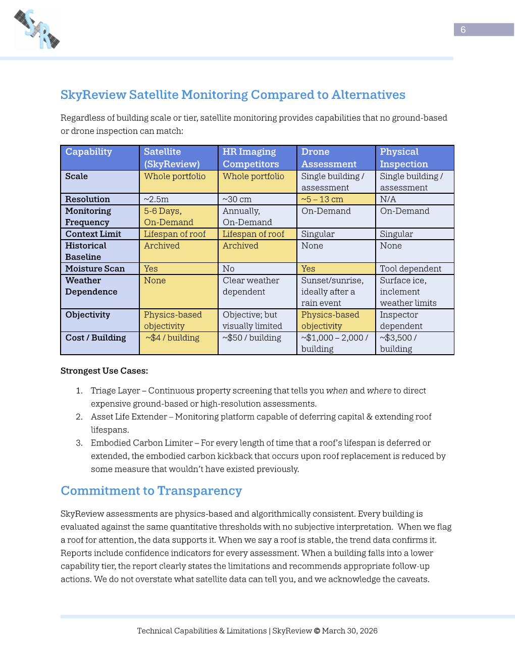
View Technical Capabilities Hide Technical Capabilities
View Advanced Literature Survey Hide Advanced Literature Survey
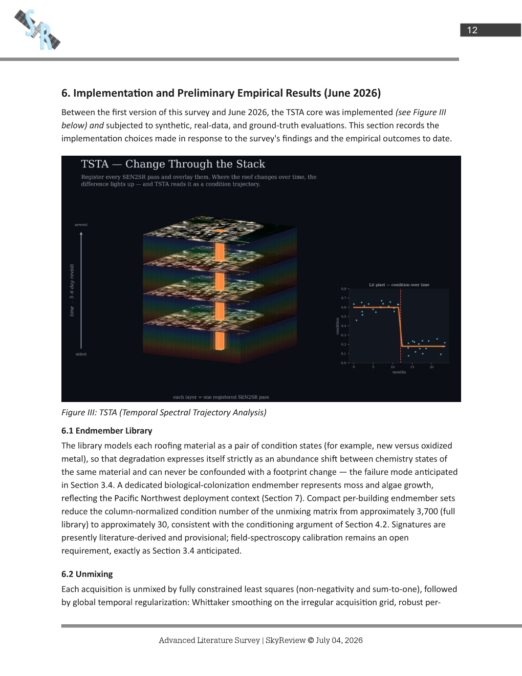
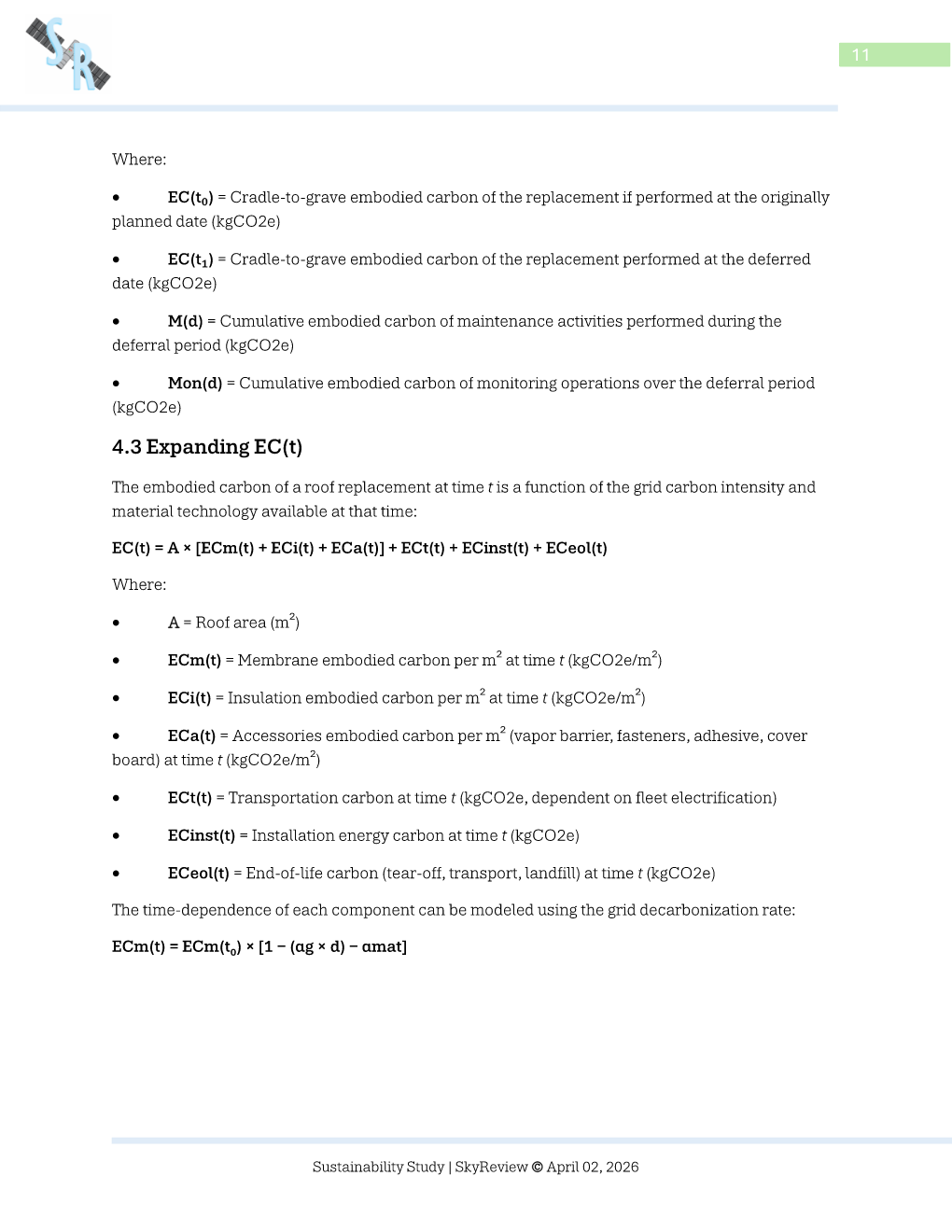
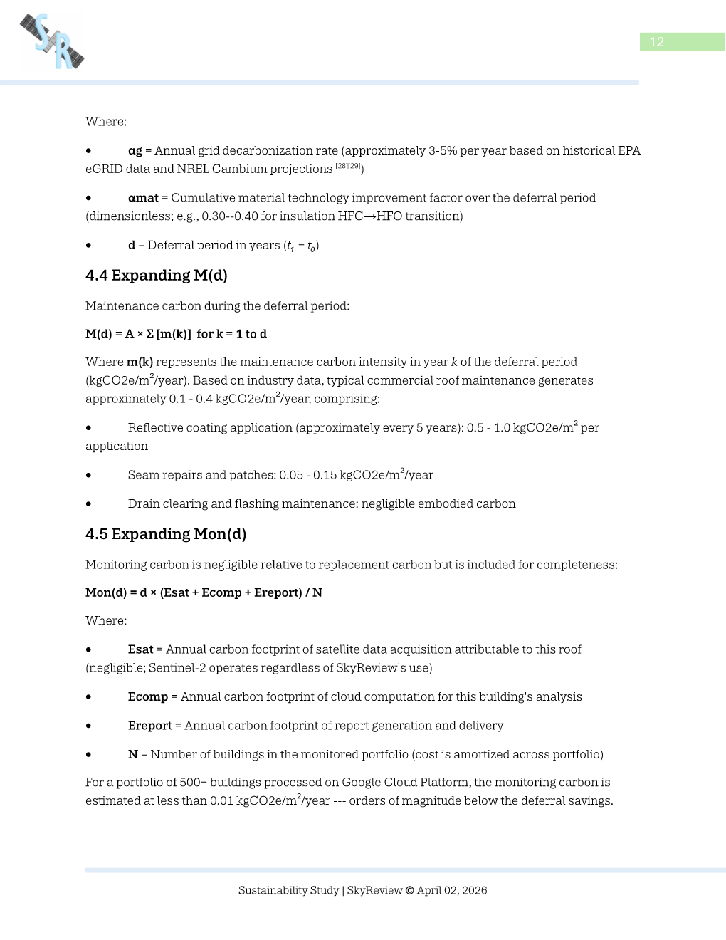
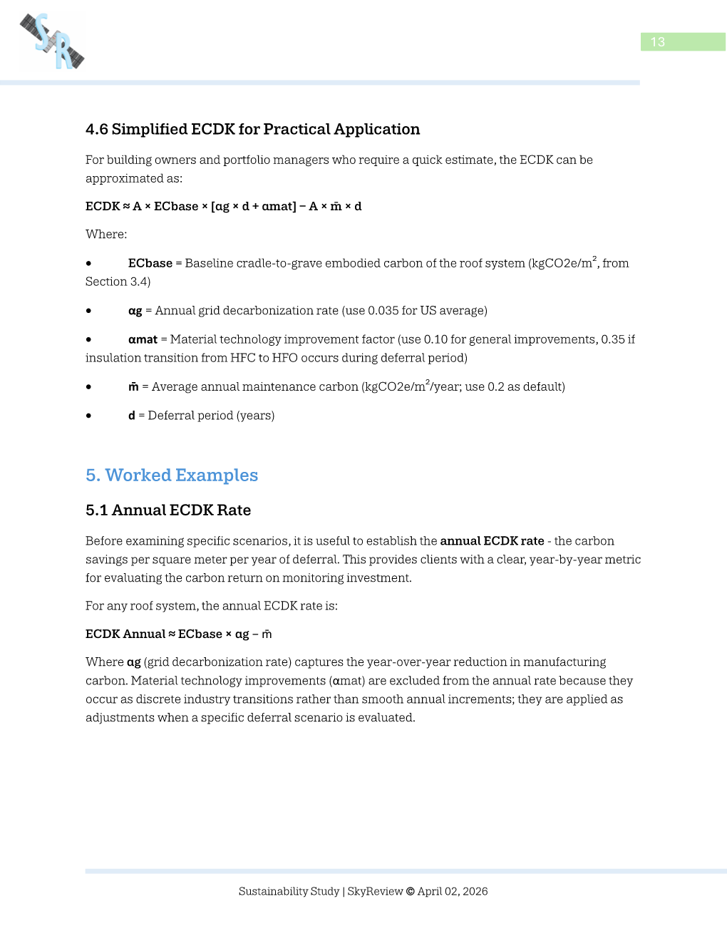
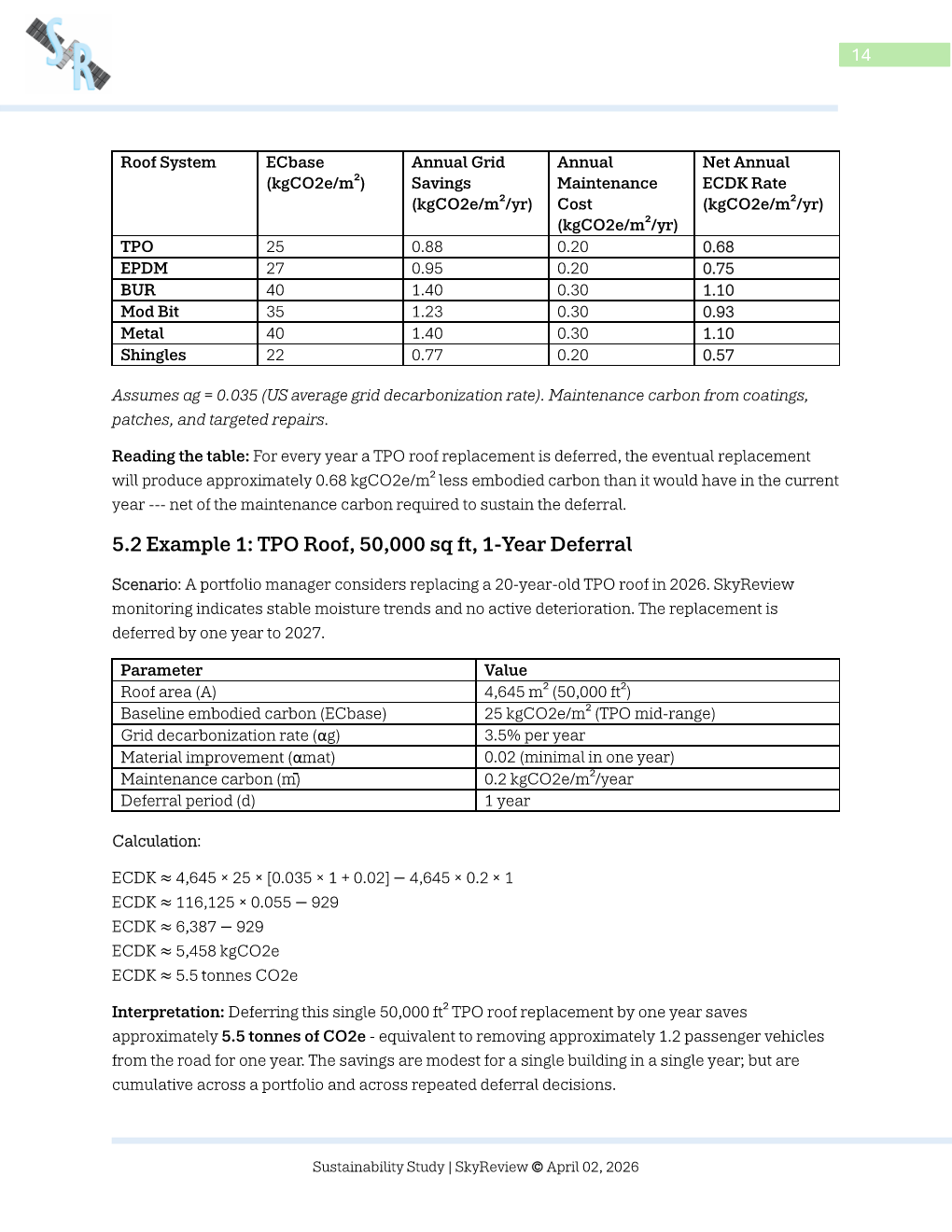
View Embodied Carbon Emissions
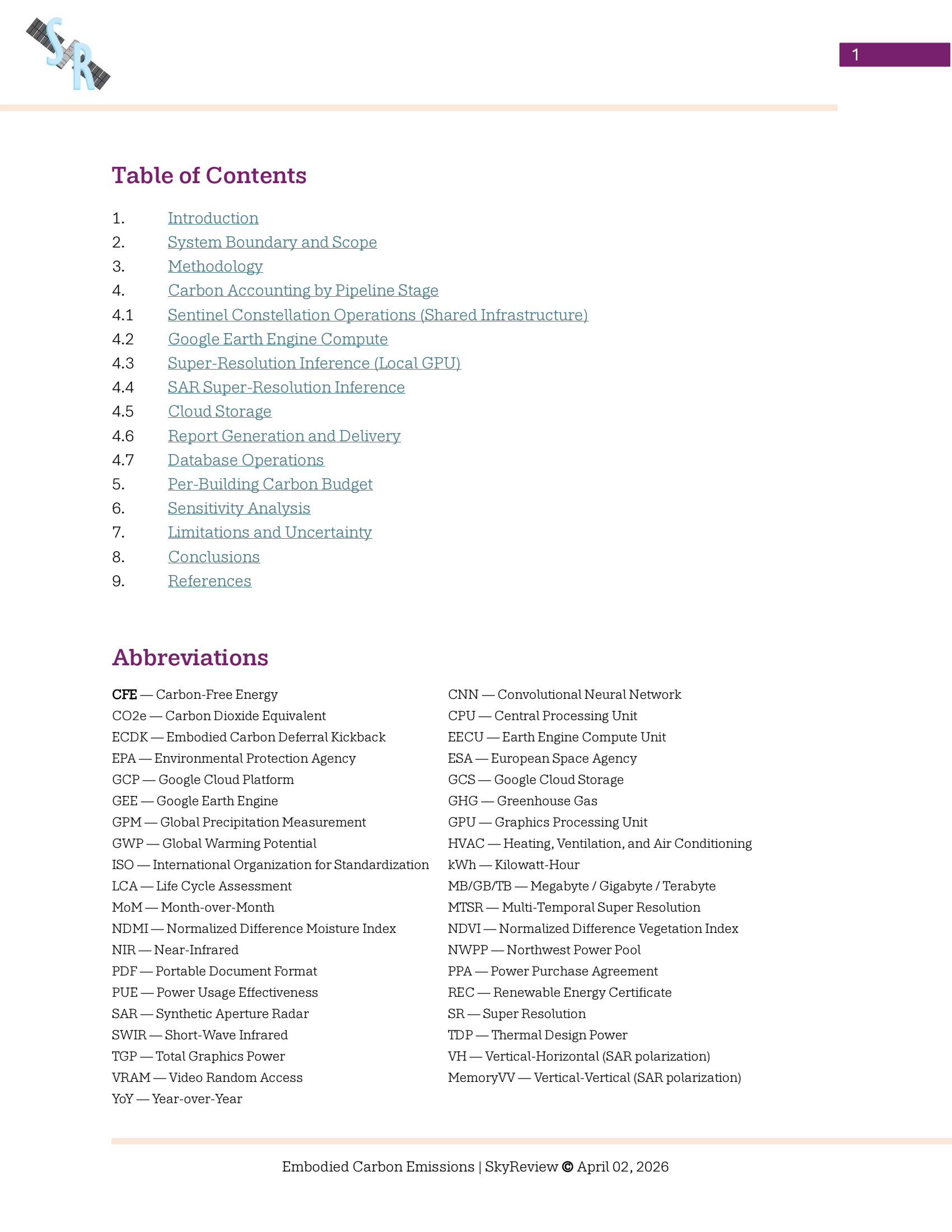
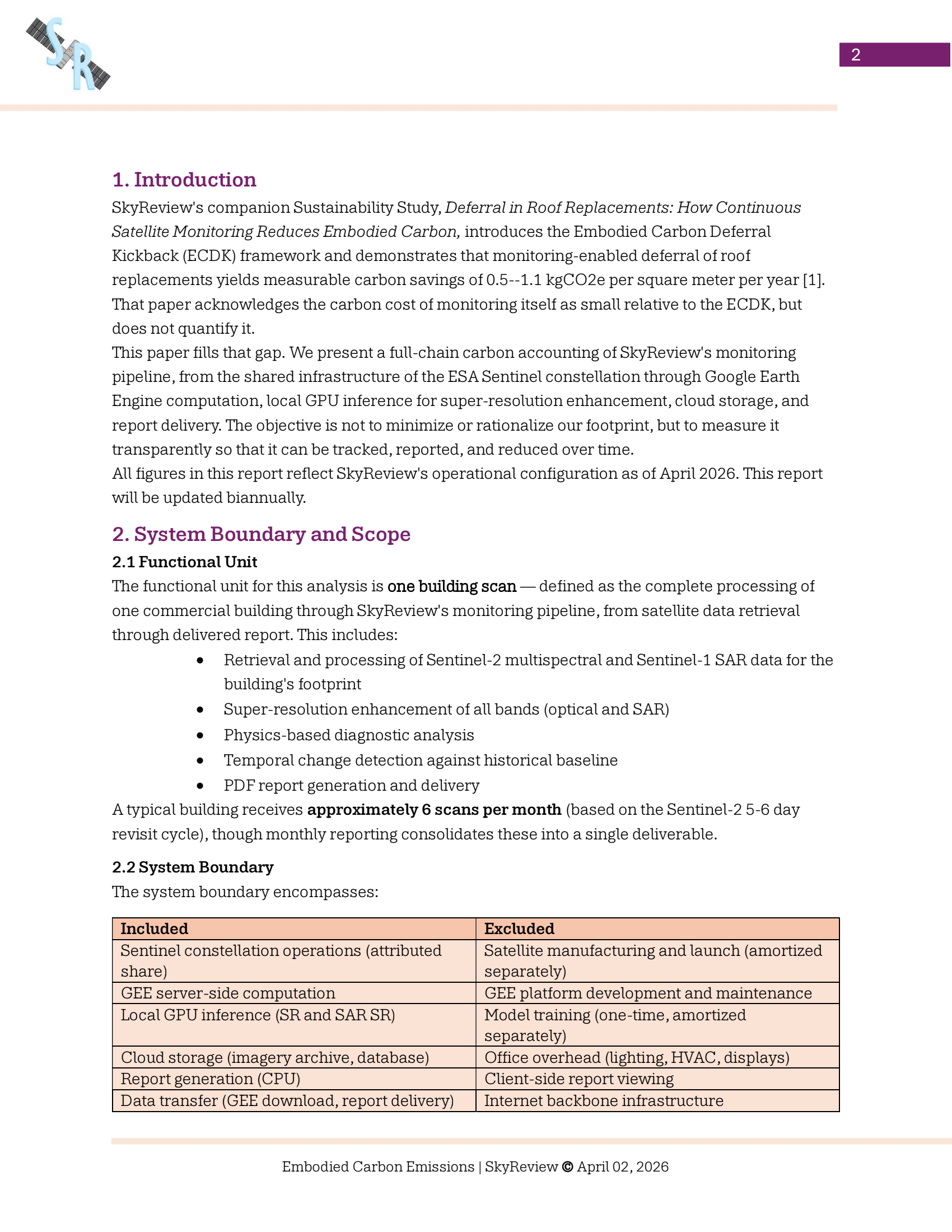
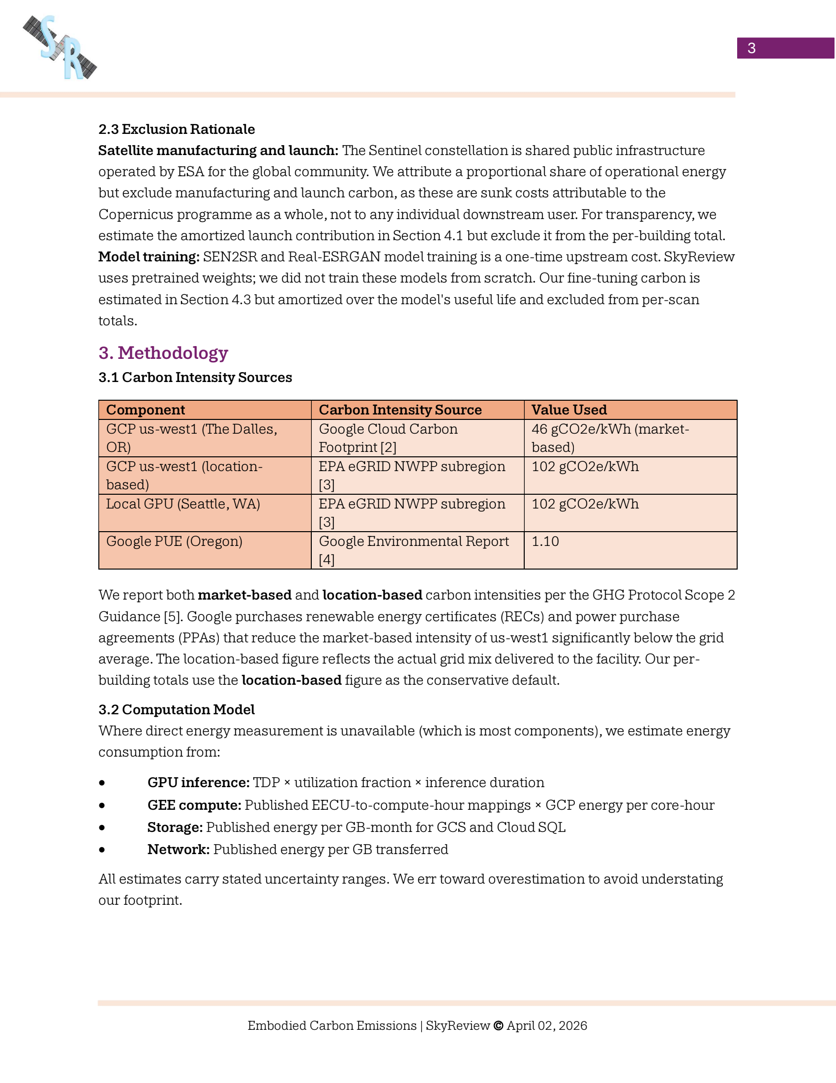
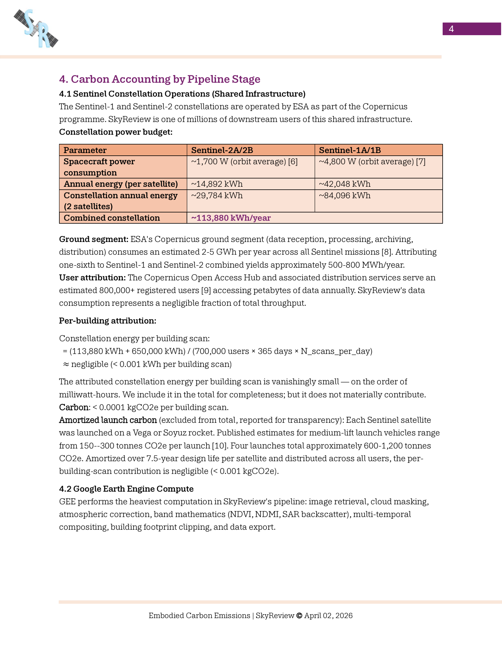
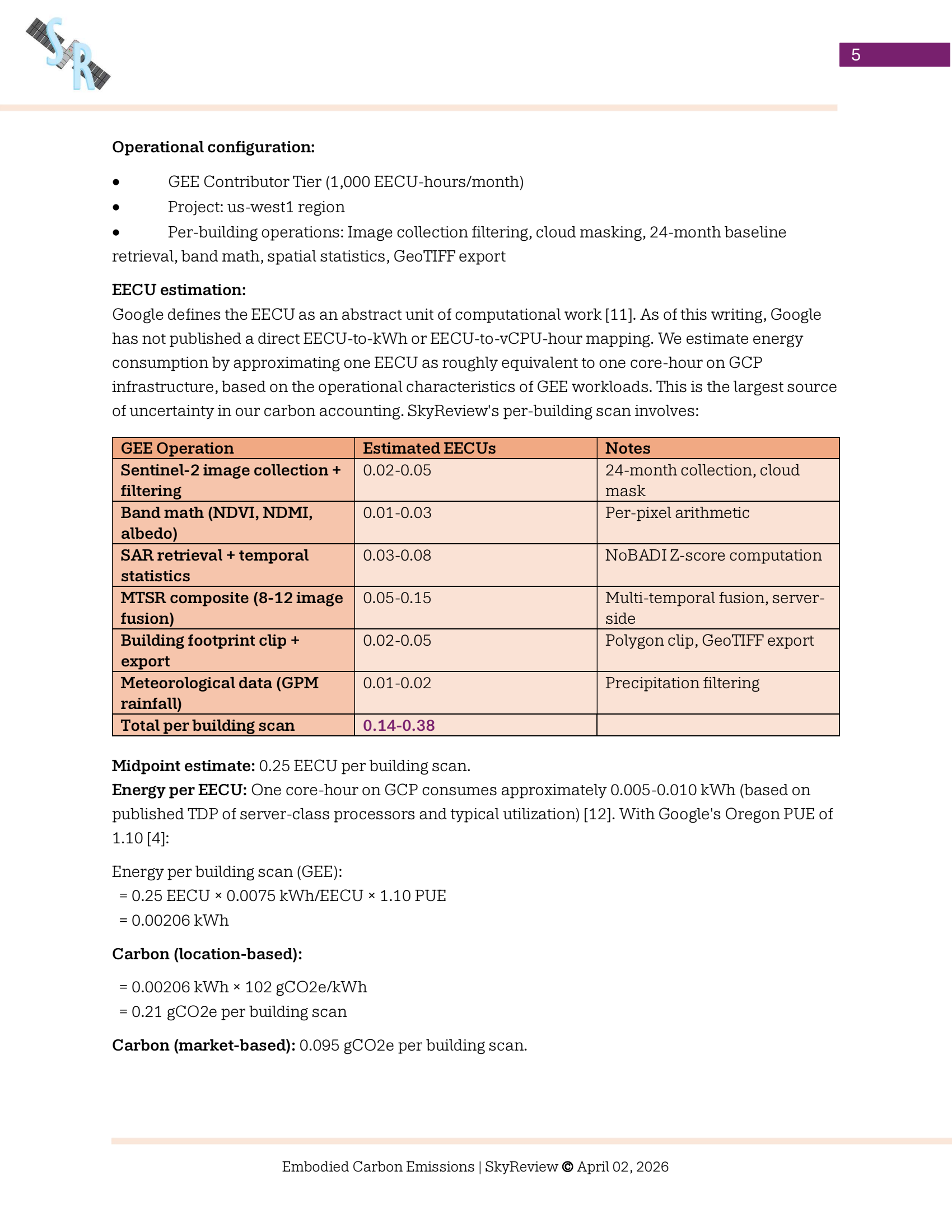

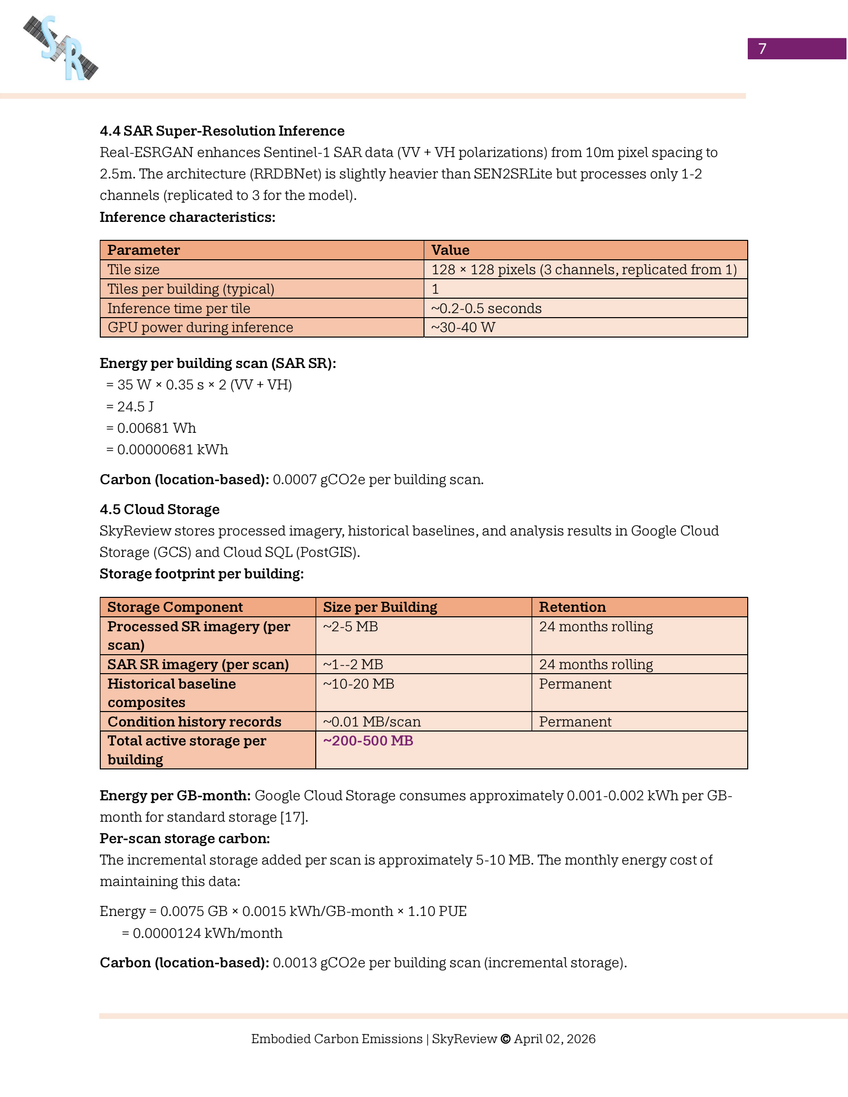
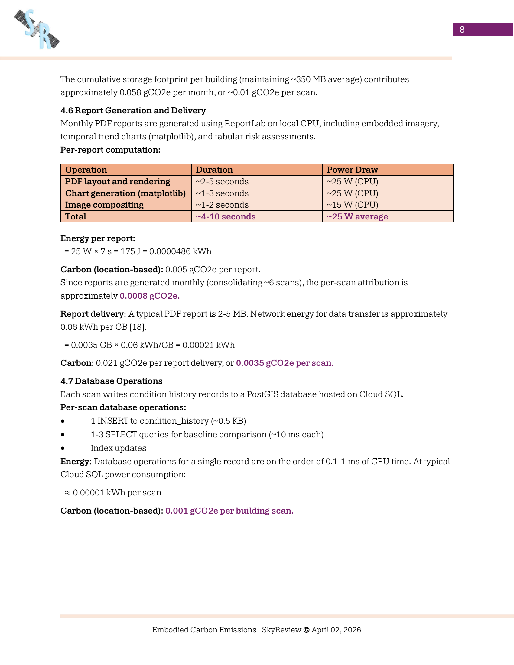
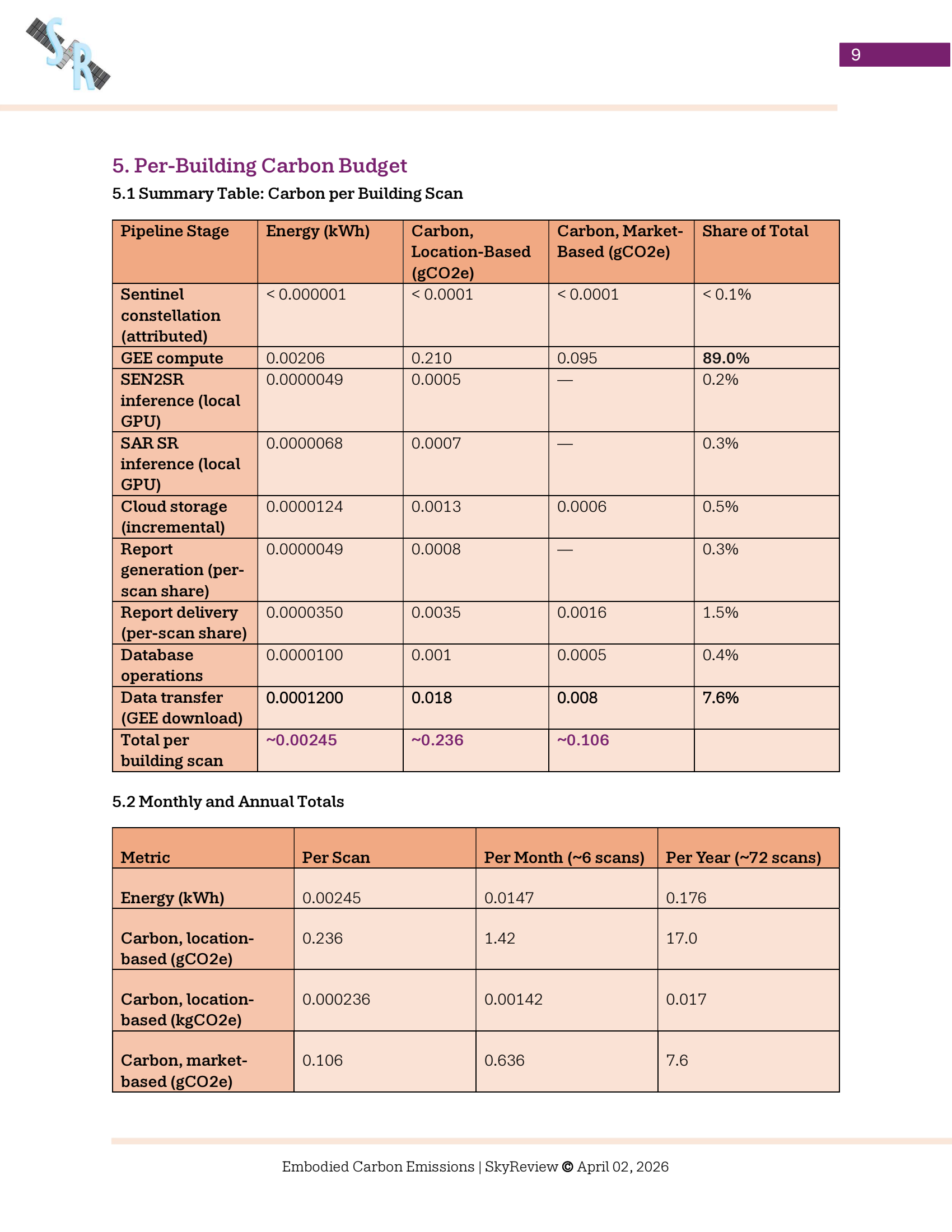
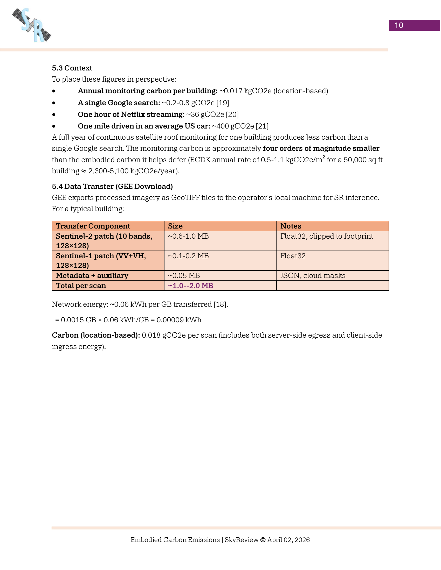
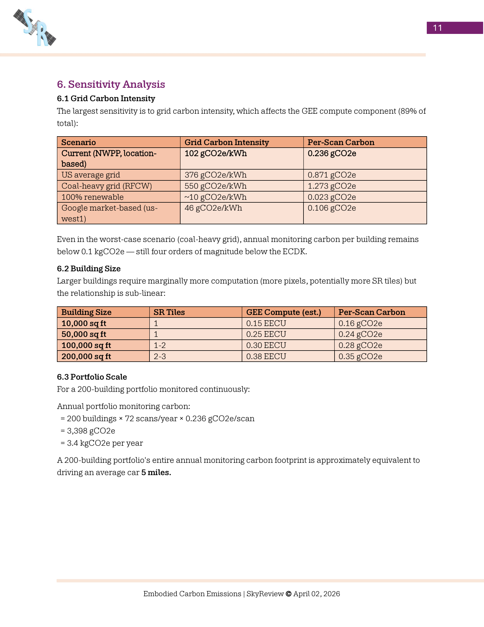
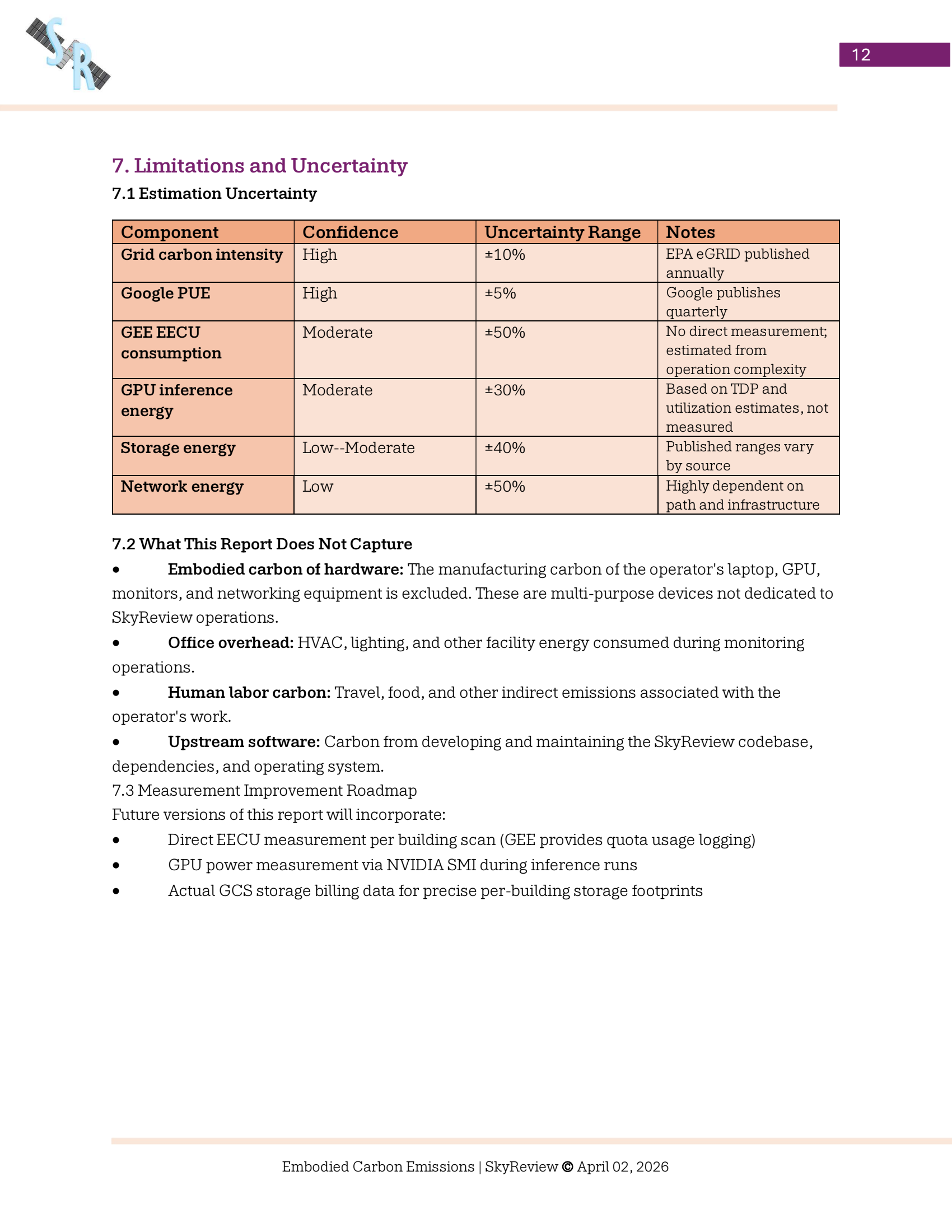
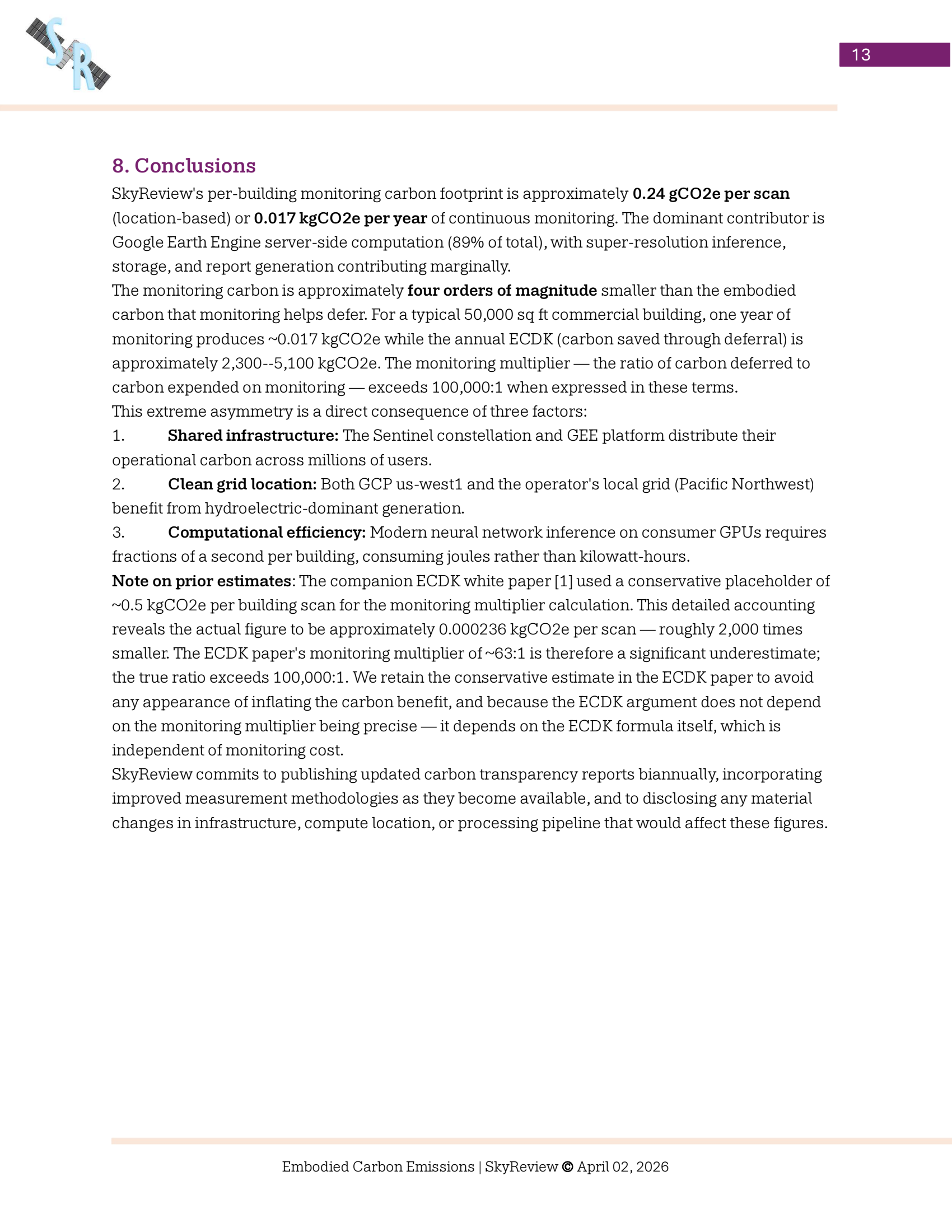
View Sustainability Study

About skyreview
About skyreview
Skyreview
Origin
SkyReview was founded in Seattle, WA by a designer & technologist who specializes in architecture, roofing, and forensic analysis. When performing whole portfolio assessments for clients, many roofs either didn't need inspection or had unknown leaks where water hadn't fully breached the roof assembly. The challenges surrounding building operations were ubiquitous. The dots connected after experimenting with geospatial technology for monitoring conditions of mountaineering routes, that it would be possible to develop remote technology to assist with roof management.

Nicholas Page, Founder
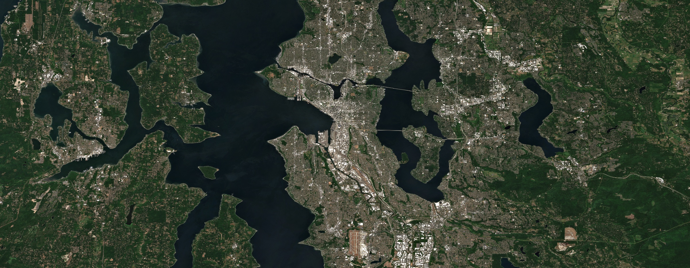
Seattle, WA - Sentinel-2 composite, 2025
Frequently asked questions
No. SkyReview provides predictive insights to help prioritize inspections and optimize resource allocation, but it does not replace the need for professional on-site evaluations. At certain risk grades, your building might be flagged for additional escalation options including on-demand HR satellite imagery or on-site inspections by an experienced building envelope inspector.
By harnessing the planetary compute of Google Earth Engine and a constellation of multispectral commercial satellites, we analyze conditions over time with the intent of identifying potential property deficiencies, risks, and moisture signatures, before they manifest as costly leaks and mold remediation. Our escalated HR imagery is manually ordered and reviewed by our team.
SkyReview offers statistical signals based on large datasets and machine learning. While valuable for portfolio prioritization and screening, final decisions should always be validated by on-site professionals.
SkyReview is designed for property owners, asset managers, facility planners, and contractors overseeing large building portfolios who need scalable, data-driven decision support. Offered globally.
We are offering limited, free Beta Access. To schedule, contact our team through the website’s contact form. We’ll reach out to coordinate and assess which properties would be most effective for our monitoring system.
1. Nature of Service
SkyReview is a SaaS (Software-as-a-Service) platform providing orbital data analytics and remote sensing observations. All data, imagery, and "signals" provided are Observations based on physics-based modeling and AI-orchestrated multispectral analysis.
2. Professional Disclaimer
SkyReview is not a licensed architectural or engineering firm. The use of the platform and its reports does not constitute the practice of architecture or professional engineering.
SkyReview does not provide stamped drawings, construction specifications, or life-safety certifications.
The founder’s professional background is used solely to calibrate the underlying logic of the software; it is not a substitute for an on-site professional consultation.
3. "As-Is" Observation (The "Scout" Rule)
Reports are based on apparent risks and anomalous signatures detected at the time of satellite capture.
No Guarantee of Accuracy: Atmospheric interference, orbital drift, and material properties can impact data.
Verification Required: All SkyReview findings are "preliminary signals" and must be verified by a licensed contractor or building envelope professional before any construction or repair actions are taken.
4. Limitation of Liability
To the maximum extent permitted by law, SkyReview’s total liability for any claim arising out of the use of our data is limited to the total amount paid by the user for the specific report or subscription period in question. SkyReview is not liable for consequential damages, including but not limited to, building failure, water damage, or loss of property value.